

Steel Fell [Dead Pike - Steel Fell]
Good walks are even better shared.
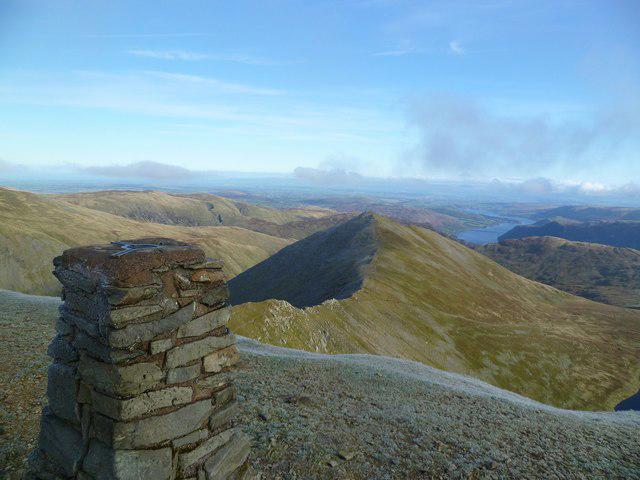
NY3211 : Looking north from the summit of Steel Fell towards Thirlmere
Graham Robson Photo source
Overview
Steel Fell [Dead Pike - Steel Fell]
Steel Fell is a remarkable hill located in the heart of the Lake District, standing tall at 582 meters. Nestled between the bustling villages of Patterdale and Grasmere, this fell is a favourite among locals and visitors alike.
Geology
This fell is primarily composed of volcanic rocks such as andesite and trachyte, traits of its ancient past when volcanic activity shaped the region. The surrounding landscape reveals glacial valleys that highlight significant geological formations, making it a paradise for geology enthusiasts in pursuit of the Earth's history.
Popular Routes
1. Patterdale to Steel Fell: This moderate 6.5 km route will take you about 3.5 hours to complete. Start your journey in the sleepy village of Patterdale, where the woodland paths will guide you upward, revealing stunning vistas as you ascend.
2. Grasmere Circular: For those looking for a bit more of a challenge, the 10 km Grasmere Circular will take approximately 4.5 hours. This route not only tests your stamina but rewards you with breathtaking views around Grasmere.
Summit Features
The summit of Steel Fell is characterised by a quaint cairn and a trig point atop a rocky outcrop. It's a perfect spot to gather your thoughts or snap a couple of joyful selfies!
Terrain and Hazards
Be prepared for a mixture of rocky paths and grassy slopes, with a few boggy sections that can surprise the unwary. Remember, the weather can change quicker than you can say 'triple shot latte', so keep your wits about you!
Views
On a clear day, the views from the summit are unparalleled. To the east, gaze upon the majestic Helvellyn range, while to the south, the iconic Langdale Pikes dominate the landscape. Spring and autumn are undoubtedly the best seasons to take it all in as you avoid the summer haze and revel in the nature's vibrant colours.
Access
Accessing Steel Fell is a doddle. With several parking options in Patterdale and regular bus services from Keswick and Windermere, you'll find it easy to reach the trailheads.
Nearby Summits
Apart from Steel Fell’s charm, you can also take a crack at nearby lofty giants like Helvellyn (950 meters) and Catstycam (889 meters).
Facilities
Upon your return, why not treat yourself to some local delights? Patterdale has a couple of charming cafes and a welcoming pub ensuring you are well-fed after your adventure. Toilets can be found at the village hall, so no worries there!
History
Steel Fell’s name comes from the Old Norse word 'stǫll', meaning 'rocky hill', a fitting description! As part of the Lake District National Park, a UNESCO World Heritage Site, this fell holds both natural beauty and cultural significance, telling tales of generations before us.
Whether you're a seasoned hiker or a weekend wanderer, Steel Fell is a destination that promises the perfect mix of adventure, scenery, and a touch of history. So lace up those boots and get ready to explore!
Explore routes near Steel Fell [Dead Pike - Steel Fell]
Walks starting near this hill. Open a route to check its map, distance and full itinerary.
Bow Fell from Langdale
View route
Scafell Pike from Seathwaite via the Corridor Route
View route
Helvellyn via Striding Edge
View route
Striding Edge, Helvellyn and Catstye Cam
View route
Route planning notes
These notes describe possible approaches. Check a route's map and access information when planning your walk.
Patterdale to Steel Fell
This route starts at the charming village of Patterdale and gently ascends towards the summit, offering a delightful mix of woodland paths and rocky ridges.
Grasmere Circular
This longer trail creates a scenic loop around the Grasmere area, making for a rewarding adventure with magnificent views of the valley.
Make a day of it, together
Find someone to share the walk with, or organise a day out along a route you like.
Photo Gallery
View all Photo could not load
NY3211 : Looking north from the summit of Steel Fell towards Thirlmere
Graham Robson
 Photo could not load
NY3211 : The path down Cotra Breast, Steel Fell
Graham Robson
 Photo could not load
NY3211 : Small tarn, Steel Fell
Michael Graham
 Photo could not load
NY3111 : Rainbow, Steel Fell
Mick Garratt
 Photo could not load
NY3211 : Cairn On Steel Fell
Michael Graham
 Photo could not load
NY3211 : On Steel Fell
Michael Graham
 Photo could not load
NY3111 : Steel Fell
David Brown
 Photo could not load
NY3111 : Frozen pool on Steel Fell 2
Trevor Littlewood
 Photo could not load
NY3111 : Steel Fell Old Fence Post
Robert Struthers

NY3111 : Summit Cairn, Steel Fell
Michael Graham
Hill facts and local notes
Classifications
Elevation
553m
1,814 ft
Prominence
83m
Coordinates
54.4912, -3.0522
NY319111
OS Map
90
Explorer: OL5S
At the Summit
The summit is marked by a small cairn and offers a picturesque trig point atop the rocky outcrop. Perfect for a selfie or two!
Terrain & Geology
Steel Fell is primarily comprised of volcanic rocks, particularly andesite and trachyte, which contribute to its rugged terrane. The surrounding landscapes include glacial valleys that showcase significant geological formations.
Views & Scenery
From the summit, enjoy splendid views of the Helvellyn range to the east and the Langdale Pikes to the south. On clear days, you can also spot the distant outline of the Scottish hills.
History & Heritage
Name Origin
The name 'Steel' is believed to come from the Old Norse word 'stǫll', meaning 'rocky hill'.
Historical Significance
Steel Fell is part of the Lake District National Park, a UNESCO World Heritage Site, recognised for its natural beauty and cultural history.
Getting There & Facilities
Parking
Patterdale Village has ample parking, allowing easy access to the starting point of various trails.
Public Transport
Frequent bus services run from Keswick and Windermere to Patterdale, making it easy to reach the trailhead by public transport.
Nearby Facilities
Patterdale features a couple of quaint cafes and a pub for refreshment. Toilets can be found at the village hall.
Safety Information
Known Hazards
- Uneven terrain can lead to slips or falls, especially after wet weather. Watch out for sudden changes in weather typical in mountain regions.
General Safety Tips
- Check weather conditions before setting out
- Carry appropriate clothing and equipment
- Let someone know your planned route
- Take a map, compass, and GPS device
- Carry emergency supplies: food, water, first aid kit, torch
Hills
Some common questions about the hills answered
Are there group walks up Steel Fell [Dead Pike - Steel Fell]?
Many walkers use Walkmates to join or organise walks with others. You can check for group walks around Steel Fell [Dead Pike - Steel Fell] through the maps
Are there other walkers around Steel Fell [Dead Pike - Steel Fell]?
Activity varies by location and time, but Walkmates lets you see whether others have shared walks or shown interest in this area. Find other people through the walking friends search walking friends for Steel Fell [Dead Pike - Steel Fell] search or of course create your own walk for Steel Fell [Dead Pike - Steel Fell]
Can I organise a walk to Steel Fell [Dead Pike - Steel Fell]?
Yes. If there aren’t any walks listed already, you can create a walk and make it available for others to join.
If you're signed up to Walkmates, you can create a walk to Steel Fell [Dead Pike - Steel Fell].
How do I find a walk up this hill?
There are often multiple ways to walk this hill, depending on experience and route preference. Walkmates helps you explore walks and routes that others have shared.
Can I suggest a new route up Steel Fell [Dead Pike - Steel Fell]?
Yes. You can suggest or create routes to share with others. Walkmates focuses on the social side of walking, so routes are used to help people organise walks and explore areas together, rather than as detailed navigation tools or route libraries.
Other uses really appreciate knowledgeable walkers sharing their routes. Share your favourite route to Steel Fell [Dead Pike - Steel Fell] here
The is an error or something incorrect about this hill. How do I let you know?
We always strive to keep the information on Walkmates as accurate as possible. If you find an error, please let us know through the contact form and we'll aim to correct it as quickly as possible
Community Discussion
Comments
Location
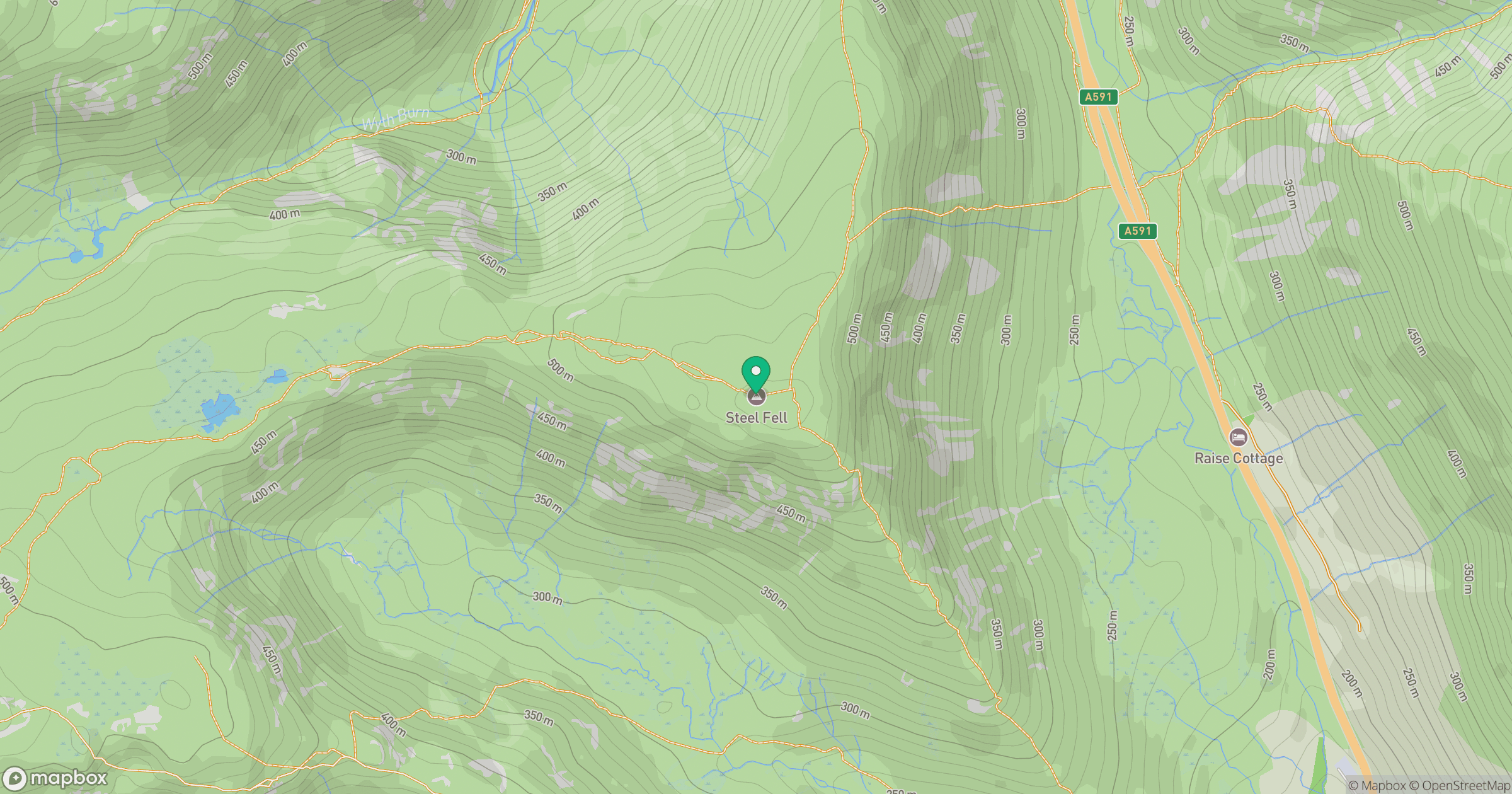
Grid reference: NY319111
View on OpenStreetMapOpens a map in a new tab, centred on the hill.
No comments yet. Be the first.